Hedgerow Rails: Finding the Glyn Valley Tramway in the Chirk Landscape
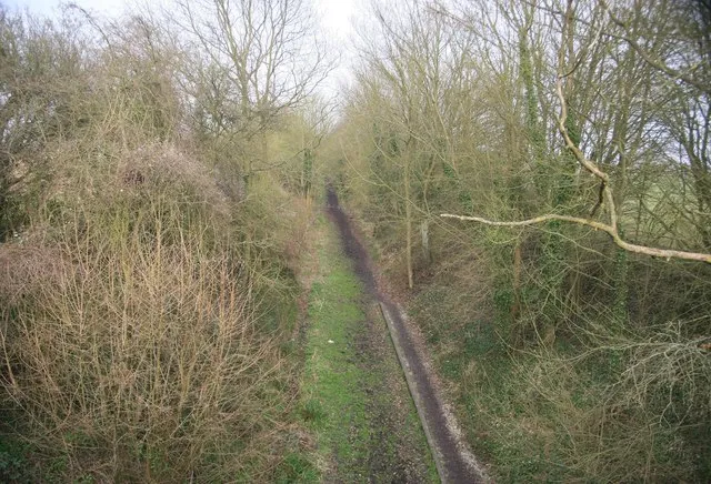
Photo: roger geach , CC BY-SA 2.0, via Wikimedia Commons
On a damp November morning in 2026, most people arriving at Chirk station turn their backs on the hills. They head for the castle, the aqueduct or the canal towpath. Fair enough. But stand on the station forecourt and look west, past the car park and the last few houses, and you are looking down the corridor of a railway that no longer exists. The Glyn Valley Tramway once left Chirk for Glyn Ceiriog, carrying slate, granite and passengers. It closed in 1935. What remains is not a museum piece but a set of clues in the landscape.
Begin at the station, not the castle
The tramway's Chirk end was a transfer point rather than a grand terminus. It connected the quarries of the Ceiriog valley with the main line and the wider world. That is why this walk starts here, not at some polished trailhead with an interpretation board and a bin. Walk west along the station approach and pick up the public footpaths towards the Ceiriog. Do not expect a sign saying Glyn Valley Tramway. Expect instead a lane that bends too sharply, then a hedge that runs suspiciously straight for half a field.
A short history of a long line
The tramway opened in 1873, with passenger services following in 1874, and it closed in 1935. It was narrow gauge, just 2ft 4½in, and it was built to do a job: move slate and granite out of the valley and move people in and out of Chirk. It hugged the valley floor, used road sections where it had to, and was never fast. The route ran roughly eight and a half miles from Chirk to Glyn Ceiriog. Its real achievement was not speed but persistence. For more than sixty years it was the practical link between the quarries, the villages and the railway.
Reading the route on the ground
Use the OS Explorer map for the Ceiriog valley and mark Chirk station, the river Ceiriog, Pontfaen, Dolywern, Pontfadog and Glyn Ceiriog. The old alignment is not a continuous trail. In places it is under tarmac; in others it is a footpath; in others it is simply a field boundary or a line of trees. The walk is a patchwork, and that is the point. You are not following a preserved railway. You are following a ghost.
From Chirk, follow the riverside paths and lanes west. The first mile is suburban, then the valley opens. Near Pontfaen the road and river trade places, and you should watch for masonry in the verge. Near Dolywern and Pontfadog the clues are quieter: a wall that holds a bank, a bridge that seems too narrow for modern traffic, a cottage with industrial proportions, a gatepost that has outlived its gate. None of these is labelled. You have to read them.
The best clues are geometric. A lane that runs too straight. A hedge with a stone base. A culvert that takes a stream under a path at a suspiciously railway-like angle. A cutting where the bank has been sliced clean. These are the fingerprints of a line that was built cheaply, maintained with whatever was to hand, and abandoned without ceremony.
The villages that grew around the line
Glyn Ceiriog was the terminus and the reason for the line. The quarries there produced slate, and the tramway moved it. The villages along the valley were not just scenery; they were the workforce and the market. The line made it possible to live in the valley and work in the quarry, or to leave for Chirk and come back the same day. When the line closed, the valley did not stop, but its rhythm changed. Road transport took over, the quarries changed, and the tramway became a story told by walls and hedges.
What the walk is like in November 2026
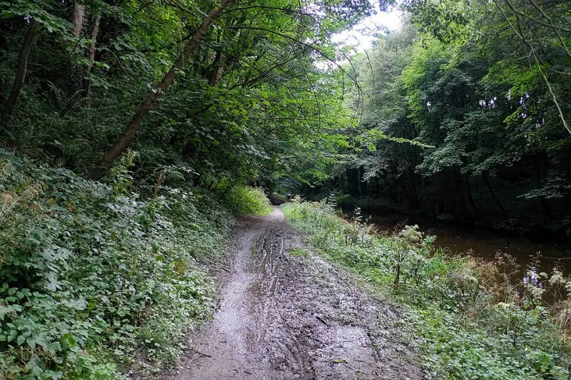
This is a linear walk of roughly eight and a half miles, so allow four to five hours at a steady pace. It is muddy in places, has short stretches of road walking and offers limited daylight in November. Start early. Wear boots, carry a waterproof and a torch, and take the map even if you have the route on your phone. Check current bus times or arrange a lift from Glyn Ceiriog for the return. Keep dogs on leads near livestock, and respect private land by sticking to public rights of way. Check opening times before relying on pubs or shops at either end.
Why the ghost line matters
Chirk's identity is usually told through the castle and the canal. The tramway adds a third strand: work. It explains why the village looks west, why the valley has chapels and terraces, and why some roads feel older than they look. The line is gone, but the corridor remains. Walking it is not about nostalgia. It is about seeing the infrastructure that made the border country, and noticing that the quietest path out of Chirk still has a story to tell.